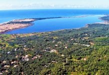
Giannades is one of those Corfu villages that thousands of visitors pass relatively close to without ever thinking of stopping.
Yet behind its quiet village square and old houses there is a surprisingly rich story: pirate raids, Venetian landowners, an unusual red dye once exported from the area, a huge lost lake shown on centuries-old maps and, on the wild coast below the village, one of Corfu’s most beautiful and difficult-to-reach hidden beaches.
Where Is Giannades?
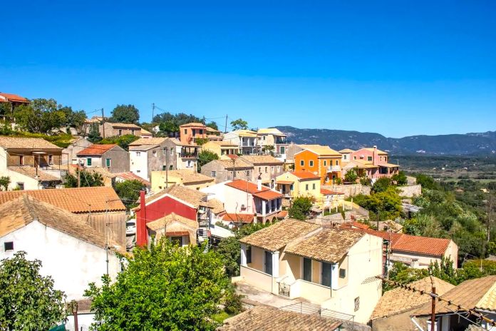
Giannades lies on the western side of central Corfu, approximately 13 km west of Corfu Town and around 7 km southeast of Paleokastritsa.
Ermones Beach is only around 3 km south of the village, while below Giannades spreads the huge green plain of the Ropa Valley.
The village itself is built on the hillside, which gives it views in completely different directions.
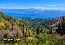
On one side you can look across the Ropa Valley. From other elevated parts of the settlement, the view extends east towards central Corfu, the Corfu Strait and, on clear days, much farther across the island.
I have visited Giannades more than once. Sometimes I explore Corfu with friends, sometimes with my dog Sinty, and quite often I simply take my camera and go alone. Photography is one of my biggest hobbies, and villages like this are perfect because you never really know what you are going to find around the next corner.
Giannades Was Originally Closer to the Sea
One of the most interesting stories about Giannades is that the village was not always located exactly where you see it today.
Historical accounts say that an earlier settlement stood closer to the western coast.
During centuries when pirate raids were a very real danger around Corfu, living close to an exposed coastline could be risky. According to local historical accounts, repeated raids eventually encouraged the inhabitants to move farther inland and establish themselves in the more protected position occupied by Giannades today, probably around the 16th century.
This explains something you notice in several old Corfiot villages: they are often positioned away from the sea even though their inhabitants depended heavily on the surrounding land and coast.
Today we search for the best sea view. Several centuries ago, not being visible from the sea could help keep you alive.
Where Did the Name Giannades Come From?
There are different theories surrounding old Corfiot place names, but one local historical tradition says that Giannades took its name from the surname of a feudal landowner associated with the area.
The village later became important not because of tourism but because of its fertile land and agricultural products.
The Strange Product That Once Made Giannades Valuable
One of the details I found most interesting while researching Giannades was something called prinokoki.

This was a valuable natural red colouring material associated with the kermes oak, known in Greek as prinos.
The intense red or scarlet dye came from tiny kermes insects living on the oak and was historically used for colouring textiles. Products connected with the oak were also valuable in traditional tanning processes.
For centuries natural red dyes were expensive commodities, and the production and export of prinokoki helped make areas such as Giannades economically interesting to successive rulers.
It is a tiny historical detail, but it tells you something important: long before tourists arrived in Corfu, villages survived through very specialised products that today most of us have completely forgotten.
The Venetians Were Interested in More Than Olives
During Venetian rule, the fertile countryside around Giannades attracted considerable attention. Olive cultivation became extremely important throughout Corfu, but the area also supported vineyards and other agricultural production. The huge wetland below the village was another valuable resource.
Over time, drainage and cultivation gradually transformed parts of the landscape into what eventually became the fertile Ropa plain we know today. Land ownership was complicated for generations, and local historical accounts connect later changes in ownership and agricultural rights with figures including Polychronis Konstantas, Konstantinos Zavitsianos and Andreas Dendrinos during the 19th and early 20th centuries.
The Lost Lake Gaudar
This is probably my favourite part of the Giannades story.
When you stand above the village and look across the enormous flat landscape of Ropa, it is difficult to imagine that the scenery below once looked completely different. Old maps of Corfu show a large lake and wetland system in this area known as Lake Gaudar.
The lake and surrounding marshland are estimated to have occupied around 16,000 stremmata, equivalent to approximately 1,600 hectares. That is an enormous area on an island the size of Corfu.

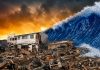
The image above is an artistic reconstruction of how the ancient lake may have looked across today’s Ropa Valley. It is not an actual historical photograph.
Lago Gaudar and Valle San Zorzi
Historical maps do not always use exactly the same name for the entire wetland.
On some maps the lake appears as Lago Gaudar, while other maps use the name Valle San Zorzi, or Valley of Saint George.
The name San Zorzi is associated with the old Church of Saint George near the Ermones and Vatos area.
The landscape was not necessarily one permanently deep body of water. Some sections consisted of shallower lakes, marshes and seasonally flooded land. During wet winters the water could spread much farther across the plain, while in the drier months some areas became suitable for grazing or cultivation.
But the Lake Is Much Older Than the Venetian Maps
The historical maps take us back several centuries, but modern science takes the story much farther into the past.
Scientists refer to the ancient lake environment as the Giannades palaeolake.
A major scientific study published in 2026 analysed a sediment core approximately 16 metres long taken from the former lake environment. The sediments preserved an environmental record stretching back more than 10,000 years.
The research indicates that a lake environment existed here for thousands of years and began undergoing major changes long before the Venetian drainage projects. This means there are really two connected stories: the prehistoric Giannades palaeolake revealed through geology and the much more recent Lake Gaudar and marsh system shown on historical maps.
Together they show that water shaped this part of Corfu for an extraordinarily long time.
How Did the Water Leave Lake Gaudar?
The water system around Gaudar was complicated. To the northeast was the watercourse known as Stravopotamos, associated in historical sources with the ancient Dafnilas.
There was also an important drainage route towards the southwest and Ermones Bay.
Over the centuries, natural waterways were increasingly modified with artificial channels in order to control the water and reclaim fertile land.
The Forgotten Watermills of Ermones
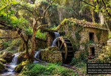
The flowing water was not wasted. During Venetian rule, several watermills operated around the outlet leading towards Ermones.
At least four early mills are recorded, while later drainage channels allowed additional mills to operate. Historical accounts suggest that the wider area may eventually have had seven or eight working watermills. These mills were important for processing grain and supporting the agricultural communities around the valley.
Today it is easy to look at a drainage channel and see nothing particularly interesting. Centuries ago, moving water here was a valuable source of power.
How Lake Gaudar Disappeared
The lake did not disappear overnight. For centuries parts of the wetland had already been changing naturally and through human intervention. Drainage works gradually redirected water towards the sea and made more land available for agriculture.
By the late 18th and early 19th centuries, large drainage projects had transformed much of the former lake and marsh into fertile land. The result was the landscape we now know as the Ropa Valley.
The Surviving Wetlands: Fontana, Gaidarana and Koritoi
The old wetland landscape has not completely disappeared.
Several small freshwater wetlands still survive in the countryside north of the Ropa Valley, and they may represent fragments of the much larger water system that once existed here. One of them is Lake Fontana, also recorded as Fontana Marsh or Fundana.
It lies only a short distance from Gaidarana and consists of several small ponds surrounded by reeds and natural vegetation.
According to the WWF Greece inventory of island wetlands, Fontana, Gaidarana and another nearby wetland called Koritoi were most probably once part of the same continuous wetland system.
Today a drainage channel separates the three areas, but their geography gives us a fascinating glimpse of what this part of Corfu may once have looked like. Fontana itself covers roughly 11 hectares and appears to retain water for much of the year.
Reeds grow around the ponds and the area remains relatively undisturbed because there is very little development nearby.
Gaidarana Lakes
A little farther east is the better-known Gaidarana wetland.
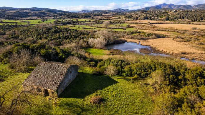
Rather than one conventional lake, Gaidarana is a network of small ponds connected by extensive reed beds.
Water remains here throughout the year, creating an important refuge for birds, amphibians, insects and other wildlife.
Old agricultural buildings can still be seen around the wider landscape, reminders of the farming activity that developed after much of the former wetland was drained.
The similarity between the old name Gaudar and the modern name Gaidarana has also led to suggestions that the name may preserve a distant memory of the former lake.
When you look at Fontana, Gaidarana and Koritoi together on a map, the story becomes even more interesting.
They look like scattered small wetlands today, but they may be surviving pieces of a landscape that was once dominated by far more water. For me, this is one of the most fascinating things about the Ropa area: the great lake disappeared, but it did not disappear completely.
Ropa Valley Is Also One of Corfu’s Birdwatching Areas
There is another reason nature lovers come to the Ropa Valley today: birdwatching.

The combination of open farmland, drainage canals, small ponds, seasonal wetlands, reeds and scrub creates several different habitats in a relatively small area.
For this reason, the valley is included in specialist birdwatching itineraries around Corfu.

Depending on the season, birdwatchers may see species such as Red-backed and Lesser Grey Shrikes, different larks, Yellow and White Wagtails, flycatchers and warblers.
Look above the open fields and you may also spot birds of prey. Marsh Harriers, Montagu’s Harriers, Common Kestrels, Common Buzzards and Red-footed Falcons have all been recorded in the wider Ropa area.
Spring and the migration periods can be particularly interesting. I think this adds another dimension to the story of the lost Giannades lake.
The enormous lake disappeared, but wetlands, ponds, reeds and drainage channels remain, and thousands of years later birdlife is still attracted to the same huge plain.
If you enjoy photography, bring binoculars and a zoom lens. The valley is enormous, so many birds are much easier to observe from a distance. If you want join the FB group Corfu Birders: https://www.facebook.com/groups/corfubirders/
The Ropa Valley Today
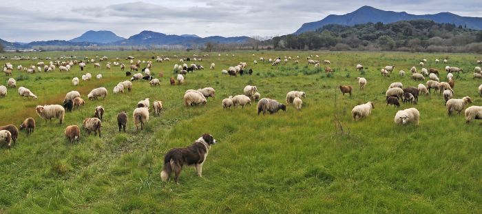
Today the Ropa Valley is one of the largest flat landscapes on Corfu. Local descriptions put the cultivated area at around 10,000 stremmata, or roughly 1,000 hectares. The contrast with the surrounding hills is remarkable because Corfu is normally an island of slopes, olive-covered mountains and twisting roads. Down here the landscape suddenly opens.
Fields, drainage channels, olive groves, reed beds and distant hills create a side of Corfu that many visitors never see because they drive directly between the airport and the beaches.


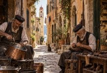
A Village That Has Preserved Its Traditional Character
Giannades has roughly 500 residents today and remains one of Corfu’s recognised traditional settlements.
One reason the village is attractive is that much of its older architecture remains visible.
You will see houses from the 18th century alongside buildings connected with different stages of Corfu’s history.
Some homes date from the period of Venetian rule, when priests, notaries, captains and other established families lived in the village. Later buildings reflect the British period and the years after the Ionian Islands were united with Greece in 1864.
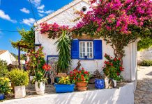
There are larger houses as well as much simpler village homes, but together they create the characteristic Corfiot architecture that makes Giannades interesting to walk through.
The streets are narrow, the houses are close together and olive trees and cypresses seem to appear everywhere around the edges of the settlement.
The Village Square
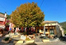
The square is the natural centre of Giannades and one of the places where I recommend stopping rather than simply driving through. From here you get a beautiful panoramic view across the fertile Ropa Valley.
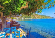
There are traditional places for coffee and food, and this is where you can slow down and watch normal village life rather than looking for a major tourist attraction.
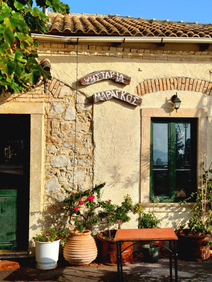
I have eaten at a local taverna here myself. The food was good, the setting was pleasant and the atmosphere felt genuinely local.
I would definitely eat in Giannades again. Sometimes a good village taverna, a quiet square and a beautiful view are reason enough to make a detour.
If you enjoy this style of place, have a look at my authentic Corfu food recommendations.
The Church of Agios Nikolaos
Above the village stands the Church of Agios Nikolaos, which dates back to the 16th century.
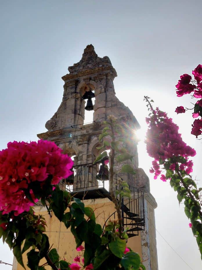
The church is another reminder that Giannades has been an established community for centuries.
Even if you are not visiting Corfu specifically for religious monuments, old village churches are worth noticing because they often preserve some of the oldest surviving pieces of local history.
My Favourite Surprise: Hidden Giali Beach Below Giannades
Most people visiting Giannades would never guess that behind the village, hidden beneath the wild cliffs of Corfu’s west coast, lies one of the island’s most spectacular secluded beaches.
It is called Giali, although you may also see it written as Gyali or Yali.
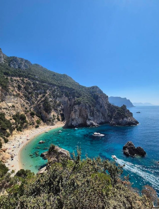
Giali is an unorganised beach surrounded by dramatic cliffs and vegetation, with fine pebbles and exceptionally clear turquoise water. There are no sunbeds, no beach bar, no toilets and no tourist facilities.
That isolation is exactly what makes it beautiful.
Giali is part of the wild western coastline extending towards the Liapades area, where several secluded beaches and coves are much easier to appreciate from the sea.
You can find Giali and more places like it in my guide to Corfu’s secret and hidden beaches.
The Giali Beach Viewpoint
You do not necessarily have to reach the beach itself to appreciate Giali.
There is a walking route from the countryside near Giannades towards a viewpoint above the beach.
One commonly used starting area is near the small Chapel of Prophet Elias outside the village.
From there, a rough track heads downhill through the countryside.
After roughly 10–15 minutes of walking, the route becomes narrower and eventually opens towards a beautiful viewpoint where you can see Giali below the cliffs.
For anyone who enjoys photography, this is one of those places where I would definitely take my camera.
The combination of pale cliffs, green vegetation and intensely blue water below is spectacular.
Important: Do Not Confuse the Viewpoint With Safe Beach Access
This is very important.
The walk towards the viewpoint and the full descent to Giali Beach are not the same thing.
Once you continue beyond the easier sections towards the actual beach, the terrain becomes considerably more difficult.
The final descent is steep, rocky, exposed and in places genuinely dangerous.
This is not a normal maintained hiking path and it should not be treated like one.
Older photographs and travel reports show ropes and improvised ladders being used on sections of the descent.
However, conditions change. Some of those ropes may be damaged, unsafe or no longer present.
Do not go there assuming that a rope or ladder you saw in an old photograph will still be waiting for you.
I would describe this as a route that needs very serious caution, particularly after the viewpoint.
I would not recommend the final descent for children, people with mobility problems, anyone afraid of heights or visitors who have no experience on steep rocky terrain. Good hiking shoes are essential. Flip-flops are completely unsuitable.
I would also avoid attempting it after rain, in strong wind, late in the day or when the rocks are wet.
Personally, I would not recommend attempting the difficult final section alone.
A beautiful photograph or a swim is never worth risking a serious fall.
The Safest Way to Reach Giali Beach
If your main goal is swimming at Giali rather than hiking, the sensible option is to arrive by sea.
Small boats and water taxis can operate from nearby Ermones, while boat trips and rentals are also available from the wider Paleokastritsa and Liapades area depending on weather and season.
Coming by boat has another advantage: you see the enormous west-coast cliffs from below, which gives you a completely different perspective of this part of Corfu. For most visitors, I consider the boat the safer and more enjoyable way to experience Giali.
A Local Business Connection
There is another Giannades connection that I find interesting because it links a small Corfiot village with one of the island’s best-known manufacturing success stories.
According to local family information that has been shared with me, the mother of Corfiot businessman Philippos Avlonitis came from Giannades.
Avlonitis founded Imperial Strom in Corfu in 1972.
What began as a tiny mattress-making operation with only two people eventually developed into a modern Corfu manufacturing company producing mattresses and sleep products.
I like details like this because villages are not only about old buildings. Their families also have connections with businesses, professions and stories that became part of modern Corfu.
A Practical Note When Exploring the Ropa Countryside
Much of the countryside around Giannades and the Ropa Valley is quiet and rural.
I often carry photography equipment when I explore Corfu, so I follow the same rule here that I use anywhere else: I do not leave a camera, phone, bag or other valuables clearly visible inside an unattended car.
Park sensibly, lock the vehicle and use normal precautions, particularly if you stop in isolated countryside.
What Else Can You Combine With Giannades?
Giannades is easy to combine with several places in western and northwestern Corfu.
Paleokastritsa is only around 7 km away, while Ermones lies just below the wider Giannades area.
You can therefore create a very different day from the usual beach-only itinerary.
Spend some time walking through Giannades, stop for coffee or lunch, look across the former Lake Gaudar and Ropa Valley and then continue towards the coast.
If you enjoy nature, you can also explore the countryside or walk towards the Giali viewpoint without necessarily attempting the dangerous final descent to the beach.
How Long Do You Need in Giannades?
If you only want to explore the village itself, one or two hours is enough for a relaxed walk, photographs and a coffee.
Add more time if you want to eat at one of the local tavernas.
If you intend to explore Ropa or walk towards the Giali viewpoint, allow considerably longer and do not treat it as a quick stop.
The route and landscape are part of the experience, and rushing on steep terrain is exactly what you should avoid.
Is Giannades Worth Visiting?
For me, definitely.
Not because Giannades has one famous monument that everybody needs to tick off a list.
It is worth visiting because several completely different pieces of Corfu meet in one relatively small area.
You have a traditional hillside village, old houses, a centuries-old church, tavernas, Venetian agricultural history and views over one of the island’s largest plains.
Then you discover that the plain below was once part of an enormous lake and wetland system.
You find old maps showing Lago Gaudar and Valle San Zorzi.
You learn about fugitives, soldiers and possible former corsairs finding refuge around the marshes.
You discover forgotten watermills and drainage channels. You learn that even the name Parelia may preserve a memory of the marsh. You discover that small wetlands still survive at Gaidarana and that Ropa remains an interesting place for birdwatching.
And on the opposite side of the hills, almost completely hidden from view, you have one of Corfu’s wildest beaches.
That combination is exactly why I enjoy exploring villages like Giannades with my camera. Sometimes the most interesting places in Corfu are the ones people drive past on their way somewhere more famous.
If you have visited Giannades, remember stories about Lake Gaudar, have been birdwatching in Ropa or have walked towards Giali, share your experience in the comments below. Local memories and first-hand information are often the best way to discover the real Corfu.
Discover the Best of Corfu!
Get local events, travel tips and important Corfu updates delivered straight to your inbox.